Posted on July 9, 2025 in Environmental Sciences Initiative

Urban flood-monitoring system, co-led by Graduate Center scientists, is being used as a model for new projects in Brazil and Puerto Rico.
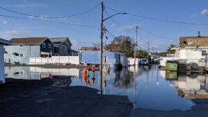
An innovative flood-monitoring network, co-led by scientists at the CUNY Graduate Center with colleagues at New York University, tracks water levels in flood-prone areas of New York City. FloodNet NYC monitors urban flooding using ultrasonic distance sensors and a dynamic database that records water levels in real-time.
Launched in 2019, the open-source, flood-monitoring system has become a model for new projects in Brazil and Puerto Rico, where climate change has brought intense storms, violent hurricanes, and severe flooding.
Real-time flood data
FloodNet teams have so far placed about 300 solar-powered sensors around New York City. The sensors measure water levels in low-lying areas — neighborhoods in Coney Island, Far Rockaway, and Staten Island, among them — sending information to servers that display data on an interactive map.
“They’re ultrasonic sensors that measure distance to the ground,” said Ricardo Toledo-Crow, director of the Next Generation Environmental Sensor Lab at the Graduate Center’s Advanced Science Research Center (CUNY ASRC), a principal investigator and instrument builder on the project. “They’re solar-powered and wirelessly connected to the network.”
